SuperMap logo
  • Products

    What is GIS

    About SuperMap GIS

    Technology System

    • Big Data GIS
    • New RS Software
    • New 3D GIS
    • Geospatial AI
    • Distributed GIS
    • Cross Platform GIS

    SuperMap GIS 2024 New!!

    • Cloud GIS Server
    • Edge GIS Server
    • Terminal GIS for Desktop
    • Terminal GIS for Components
    • Terminal GIS for Web
    • Terminal GIS for Mobile

    Previous Versions

    • SuperMap GIS 2023
    • SuperMap GIS 11i(2022)
    • SuperMap GIS 10i(2021)
    • SuperMap GIS 10i(2020)
    • SuperMap GIS 10i
    • SuperMap GIS 9D(2019)
  • Solutions

    Smart City

    Natural Resource

    Land Management

    Facility Management

    Public Safety

    Natural Disasters

    Transportation

    Water Conservancy

    BIM+GIS

  • Stories
    • Articles
    • News
    • Events
    • Magazines
  • Support
    • Download & Online Help
    • Online Demonstration
    • Ask & Answer
    • Discover SuperMap GIS
    • Trial License
  • About
    • lntroduction
    • Careers
    • Contacts
    • Suggestions
 
  • English
  • 中文
  • Español
  • Français
  • ภาษาไทย
  • русский
  • Türkçe
  • Português
  • 日本語
  • 한국어
  • Indonesian
  • عربي
Public Safety

Public Safety Solutions

  • Home
  • Solutions
  • Public Safety

Public Safety

  • BIM
  • Disasters
  • Land
  • Water
  • Transportation
  • Safety
  • Facility
  • City
  • Resource
  • 3D Visualization Platform for Social Governance

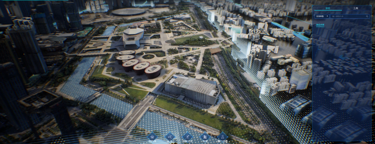
    The 3D Visualization Platform for Social Governance was developed by Shanxi Provincial Investment Group Information Technology Co., Ltd. based on SuperMap GIS technologies. It is used to facilitate the three-dimensional social public security defense syst…

    30 Dec,2022
    3D Visualization Platform for Social Governance
  • Fire-fighting Digital Plan Formulation Management System

    In traditional fire-fighting information systems, most of the maps used are images and vector maps. However, firefighters cannot intuitively see the indoor and underground conditions through image maps and vector maps, which brings great challenges to the…

    27 Dec,2022
    Fire-fighting Digital Plan Formulation Management System
  • GIS-based Gas Safety All-in-One Smart Defense Solution

    In recent years, city gas users and indoor gas facilities are rapidly increasing, which gives rise to more gas safety risks. To facilitate the safety management of gas in cities, SuperMap utilizes digital twin technology to create a “Gas Safety All-in-On…

    02 Dec,2022
    GIS-based Gas Safety All-in-One Smart Defense Solution
  • “One Map” GIS Solution for Smart Emergency Management in Wenzhou City

    This project covers typhoon storms, mountain reservoirs, flood disasters, geological disasters, as well as production and business, road traffic, marine fishery ships, city gas, etc., and has initially formed the "air-space-ground-sea integrated, dep…

    30 Nov,2022
    “One Map” GIS Solution for Smart Emergency Management in Wenzhou City
  • 3D Digital Plan Platform for Rescue and Firefighting Through 2D&3D GIS Integration

    Gansu Province 3D Digital Plan Platform for Rescue and Firefighting, based on the geospatial database and adopting the method of 3D display, proposes a new rescue and firefighting drill method - online drilling. Integrating ordinary digital plans and 3D d…

    31 Oct,2022
    3D Digital Plan Platform for Rescue and Firefighting Through 2D&3D GIS Integration
  • Urban Delivery Route Planning Service during Covid-19 Pandemic Lockdown

    The inefficiency of distribution at the moment of the pandemic lockdown has caused some materials to be unable to be quickly delivered to households."Dituhui (part of SuperMap) Route Planning" has been innovatively utilized by Shanghai volunteer…

    26 Apr,2022
    Urban Delivery Route Planning Service during Covid-19 Pandemic Lockdown
  • GIS Applications in Epidemic Prevention and Control

    Nanjing Guotu supports thematic application of public security and epidemic prevention

    24 Mar,2020
    GIS Applications in Epidemic Prevention and Control
  • Grid Management in Helping Prevent and Control the Epidemic

    ​Many cities and districts across the country has take communities and villages as the important control and management sectors in epidemic management.

    19 Feb,2020
    Grid Management in Helping Prevent and Control the Epidemic
  • GIS in Epidemic, What We Do in Provincial Provention

    During the Chinese Spring Festival, SuperMap has turned the epidemic prevention and controlling projects into the highest response level.

    19 Feb,2020
    GIS in Epidemic, What We Do in Provincial Provention
  • City Digital Plan and Management Platform

    The city digital plan and management platform is built to standardize the construction of fire rescue plans and consolidate the information operation.

    10 Feb,2020
    City Digital Plan and Management Platform
<<< < 1 2 > >>>

SuperMap GIS

  • Cloud GIS Server
  • Edge GIS Server
  • Terminal GIS for Desktop
  • Terminal GIS for Components
  • Terminal GIS for Web
  • Terminal GIS for Mobile

Stories

  • Articles
  • News
  • Magazines
  • Events

Support

  • Download & Online Help
  • Online Demonstration
  • FAQ
  • Demo Code
  • Technical Docs
  • Training Files
  • Videos
  • Trial License

Events

  • [list:pagetitle] [list:targetlink]
  • {/zzz:list}

About

  • lntroduction
  • Careers
  • Contacts
  • Suggestions

Follow Us

  • LinkedIn
  • Facebook
  • Twitter
  • Instagram
  • YouTube
© 1997-2023 SuperMap Software Co., Ltd.
  • | Privacy