Digital housing leverages advanced technologies like AI, IoT, BIM (Building Information Modeling), and digital twins to transform traditional housing management and urban development. It enhances efficiency while bringing better services for citizens.
Leveraging decades of expertise in geospatial intelligence software and practical experience in housing and urban-rural development projects, SuperMap proposes the "Data Resource System + Digital Infrastructure Platform" solution (hereafter "the foundation") to accelerate digital transformation in the sector.
ⅠBuilding the Data Resource System
1.Establishing Data Governance Standards
The foundation focuses on data and application standards, aiming to ensure data accessibility and continuous updating. It establishes a three-tiered standardization system—data specifications, service protocols, and operational guidelines—covering seven stages: data aggregation, processing, storage, exchange, sharing, services, and application. This ensures interoperability of data and capabilities across business information systems.
2.Integrating Full-Spectrum Data
The foundation integrates geospatial data, disaster risk surveys of buildings and municipal facilities, IoT data, and more into a unified data foundation. It pools resources in the Digital Housing Big Data Center, enabling holistic lifecycle management of data.
Aggregation and Governance of Multi-Source Spatio-temporal Data
The foundation employs key technologies to fuse heterogeneous data, which puts together different types of data that describe city information into the CIM (City Information Modeling) platform. The data will then be used as a spatio-temporal foundation for digital twin city development, which will support city-wide planning, construction, and operations.
Spatio-temporal Coding for Buildings and Infrastructure
Using Beidou Code spatial coding technology, the foundation assigns unique spatio-temporal identifiers to buildings and infrastructure. Integrated with public security’s primary data, it enables cross-departmental interoperability and dynamic management. Microservices architecture and blockchain ensure code uniqueness, enabling full lifecycle tracing from planning to demolition for smart city and public safety application scenarios.
Business Resource Data Matching and Mapping
Through a unified address-matching engine, the foundation links multi-source business data (e.g., buildings, construction firms, permits) to corresponding addresses, spaces and businesses in the maps, enabling comprehensive data aggregation and visualization. This creates a shared resource pool for cross-departmental collaboration.
Unified Data Management and Sharing
The foundation enables lifecycle management of spatial and business data through a unified technical framework. It supports online review, updates, error correction, and multi-source data fusion modeling to build the standard data resource pool. It adopts metadata-driven automation to ensure data quality, and blockchain technology to realize secure cross-departmental sharing.
Ⅱ The Digital Infrastructure Platform
Built on the CIM platform and enhanced by data analytics, AI, simulation, and IoT, the foundation enables data fusion and sharing, visualization and management, automated approval processes, and urban operations monitoring. It provides a "unified data foundation" and "unified digital infrastructure" to advance integrated governance in housing and urban-rural development.
1.Six-Dimensional CIM Platform
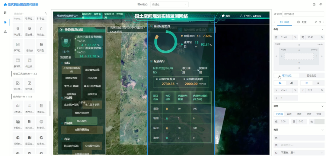
The foundation establishes a "Six-in-One" CIM platform (2D/3D, indoor/outdoor, above/below ground, static/dynamic, macro/micro, historical/current) for deep integration of spatial and business data. Compatible with BIM, oblique photography and other types of data, the CIM platform supports PB-scale data management and dynamic updates. It also enables microservices-based secure sharing across departments.
2.AI + Simulation: Empowering Smarter Urban Decisions
Through AI-driven simulation, the digital infrastructure platform constructs dynamic spatio-temporal models for traffic flow prediction, disaster risk assessment, and population distribution analysis. Leveraging algorithms like Geographically Weighted Regression (GWR) and Spatio-Temporal Convolutional Networks (ST-CNN), alongside LLMs like DeepSeek, it conducts geospatial analysis and delivers data-driven insights for urban planning and emergency management.

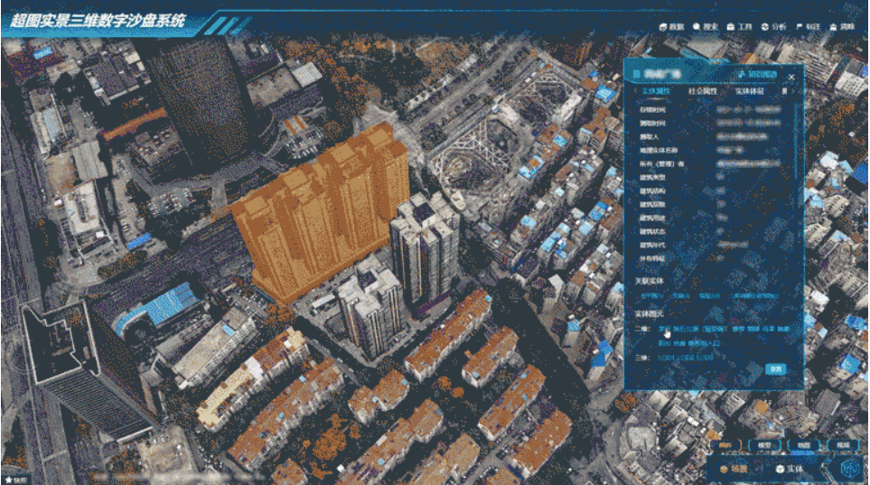
Building information extraction by AI
Powered by SuperMap's cloud-edge-terminal integrated GIS platform, the platform excels in high concurrency, performance, security, fidelity, and low-code adaptability.

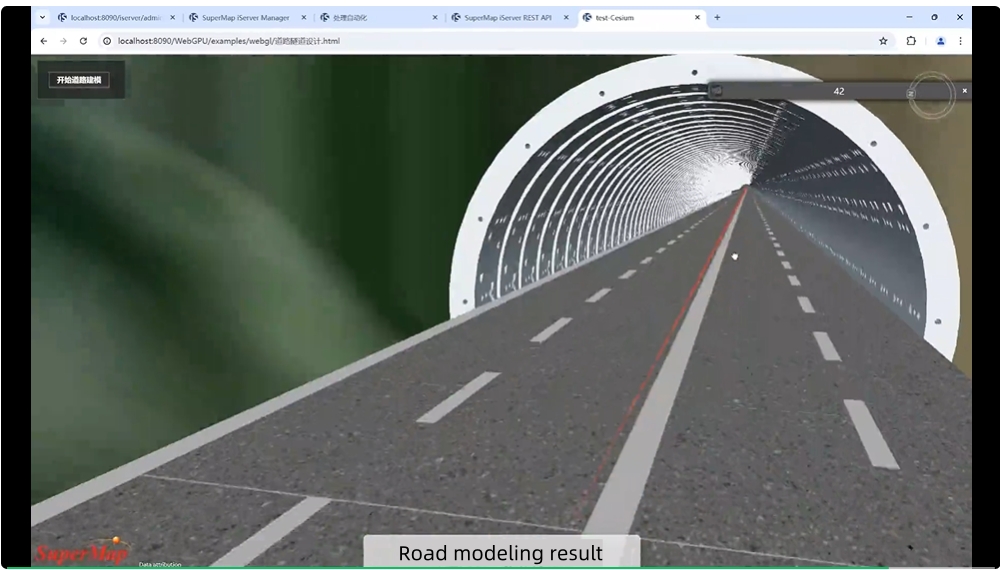
Simulation of Bridge Load Condition
SuperMap will deepen AI and simulation applications to enhance housing security, municipal infrastructure safety, urban operations, and building risk management. By advancing the platform’s capabilities, we aim to build resilient cities and drive high-quality, modernized development in global housing and urban-rural sectors.